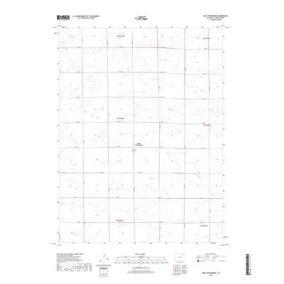
2019 Map of Saint Petersburg
USGS Topo · Published 2019About this map
Saint Petersburg anchors this section of Logan County, characterized by a vast grid of agricultural roads and the seasonal drainage of Sandy Cr. The settlement pattern is defined by the intersection of Co Rd 18 and Co Rd 81, where the localized landmark of Saint Peters Cem provides a focal point for genealogical research and local history. The landscape is marked by the high plains of northeastern Colorado, organized strictly by the Public Land Survey System, including townships such as t7n r49w and t7n r48w. This map captures the area as it appeared in the late 2010s, showing a sparse but persistent rural network where long, straight county roads like Co RD 26 and Co RD 75 trace the terrain's subtle elevation changes across the sections.
Find a feature on this map
24 named features on this map. Tap any name to fly to it.
Don’t see what you’re looking for? This feature index may not catch every label — zoom into the map to look around manually.
Map Details
Editions of this 2019 Saint Petersburg Map
This is the sole edition of this map. No revisions or reprints were ever made.
Other maps of this area

1954 · Sterling
USGS Topo · 1:250,000

1958 · Sterling
USGS Topo · 1:250,000

1962 · Fleming
USGS Topo · 1:24,000

1962 · Uhler Ranch
USGS Topo · 1:24,000

1962 · Haxtun West
USGS Topo · 1:24,000

1972 · Clarkville
USGS Topo · 1:24,000

1972 · New Haven
USGS Topo · 1:24,000

1972 · Glacken Hill
USGS Topo · 1:24,000

1972 · St Petersburg
USGS Topo · 1:24,000

1972 · Rockland
USGS Topo · 1:24,000