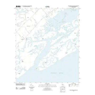
2011 Map of Saint Phillips Island
USGS Topo · Published 2011About this map
St Helena Island dominates the northern reaches of this coastal map, where a network of local roads such as James D Washington Rd and Seaside Rd connect long-standing rural communities. The map provides significant genealogical value through the documentation of the Frogmore Cemetery, Pritchard Cemetery, and Perry Cemetery, which are situated among the settlements of Longwood and Scott. These locations reflect the established cultural landscape of the South Carolina Sea Islands during the early 21st century.
Find a feature on this map
46 named features on this map. Tap any name to fly to it.
Don’t see what you’re looking for? This feature index may not catch every label — zoom into the map to look around manually.
Map Details
Editions of this 2011 Saint Phillips Island Map
This is the sole edition of this map. No revisions or reprints were ever made.
Other maps of this area

1920 · St. Helena Sound
USGS Topo · 1:62,500

1920 · Hilton Head
USGS Topo · 1:62,500

1944 · Fort Fremont
USGS Topo · 1:62,500

1945 · Hilton Head
USGS Topo · 1:62,500

1947 · Savannah
USGS Topo · 1:250,000

1948 · St. Helena Sound
USGS Topo · 1:62,500

1948 · Savannah
USGS Topo · 1:250,000

1956 · Frogmore
USGS Topo · 1:24,000
1956 · Hilton Head
USGS Topo · 1:24,000
1956 · Parris Island
USGS Topo · 1:24,000