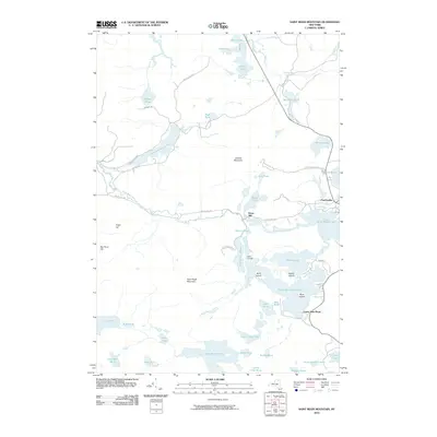
2010 Map of Saint Regis Mountain
USGS Topo · Published 2010About this map
Paul Smiths and the surrounding lake country of the Adirondack Park define this landscape, where the interconnected waters of Spitfire Lake, Upper Saint Regis Lake, and Lower Saint Regis Lake have long served as a center for Adirondack camp culture. The presence of Camp Topridge on a narrow neck of land between the lakes and Spectacle Ponds highlights the era of grand mountain retreats. To the west, the terrain rises toward the prominent peak of Saint Regis Mountain and Sugar Hill, overlooking a dense network of smaller water bodies such as Fish Pond, Ochre Pond, and Quebec Pond. The Saint Regis River flows through the center of the sheet near Keese Mill, while the Osgood River cuts through the northern reaches near Chain Lake. This 2010 survey reflects a landscape preserved for recreation, showing the enduring geography of the northern Adirondack wilderness.
Find a feature on this map
58 named features on this map. Tap any name to fly to it.
Don’t see what you’re looking for? This feature index may not catch every label — zoom into the map to look around manually.
Map Details
Editions of this 2010 Saint Regis Mountain Map
This is the sole edition of this map. No revisions or reprints were ever made.
Other maps of this area

1902 · Saranac
USGS Topo · 1:62,500

1904 · Saranac
USGS Topo · 1:62,500

1905 · Saint Regis
USGS Topo · 1:62,500

1906 · Loon Lake
USGS Topo · 1:62,500

1908 · Loon Lake
USGS Topo · 1:62,500

1921 · Santa Clara
USGS Topo · 1:62,500

1923 · Santa Clara
USGS Topo · 1:62,500

1948 · Ogdensburg
USGS Topo · 1:250,000

1951 · Ogdensburg
USGS Topo · 1:250,000

1953 · Ogdensburg
USGS Topo · 1:250,000