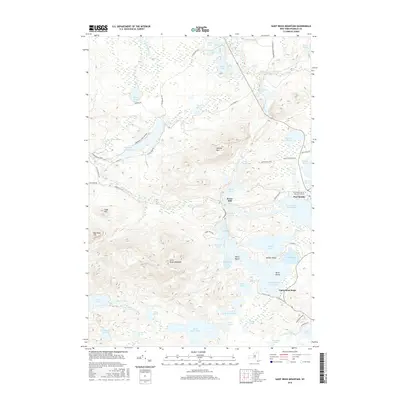
2016 Map of Saint Regis Mountain
USGS Topo · Published 2016About this map
Paul Smiths Coll of Arts and Science stands as a focal point in this landscape of the northern Adirondacks, situated between the shores of Lower Saint Regis Lake and Osgood Pond. The map reveals a sophisticated network of waterways and portages, including the St Regis Carry and St Regis Carry Rd, which connect the extensive lake systems that historically facilitated travel through the high country. To the west, the prominent peak of Saint Regis Mountain overlooks a series of smaller water bodies such as Spectacle Ponds and the secluded Black Pond. The settlement at Keese Mill and the surrounding tracts of the Adirondack Park reflect the region's enduring character as a center for wilderness education and forestry. Local roads like Keese Mills Rd and Blue Mountain Rd provide access to the various pond and marsh environments fed by the Saint Regis River.
Find a feature on this map
64 named features on this map. Tap any name to fly to it.
Don’t see what you’re looking for? This feature index may not catch every label — zoom into the map to look around manually.
Map Details
Editions of this 2016 Saint Regis Mountain Map
This is the sole edition of this map. No revisions or reprints were ever made.
Other maps of this area

1902 · Saranac
USGS Topo · 1:62,500

1904 · Saranac
USGS Topo · 1:62,500

1905 · Saint Regis
USGS Topo · 1:62,500

1906 · Loon Lake
USGS Topo · 1:62,500

1908 · Loon Lake
USGS Topo · 1:62,500

1921 · Santa Clara
USGS Topo · 1:62,500

1923 · Santa Clara
USGS Topo · 1:62,500

1948 · Ogdensburg
USGS Topo · 1:250,000

1951 · Ogdensburg
USGS Topo · 1:250,000

1953 · Ogdensburg
USGS Topo · 1:250,000