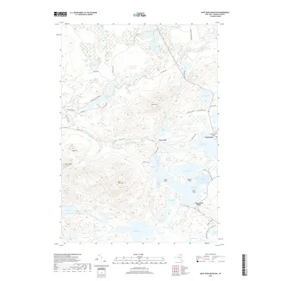
2019 Map of Saint Regis Mountain
USGS Topo · Published 2019About this map
Paul Smith's College sits at the eastern edge of this landscape, a historic center of education and community life near the shores of Lower Saint Regis Lake. The surrounding terrain is a complex network of glacial ponds and wetlands, dominated by the peaks of Saint Regis Mtn and Jenkins Mtn. Waterways like the Saint Regis River and its branches, including the W Br Saint Regis River, connect numerous small bodies of water such as Fish Pond, Ochre Pond, and Slush Pond. Human activity is concentrated along early routes like Keese Mills Rd and the settlement at Keese Mill. The map documents historic portage paths like the St Regis Carry, which links Upper Saint Regis Lake to the interior pond systems, reflecting the area's long-standing character as a destination for navigation and recreation within the Adirondack Park Preserve.
Find a feature on this map
64 named features on this map. Tap any name to fly to it.
Don’t see what you’re looking for? This feature index may not catch every label — zoom into the map to look around manually.
Map Details
Editions of this 2019 Saint Regis Mountain Map
This is the sole edition of this map. No revisions or reprints were ever made.
Other maps of this area

1902 · Saranac
USGS Topo · 1:62,500

1904 · Saranac
USGS Topo · 1:62,500

1905 · Saint Regis
USGS Topo · 1:62,500

1906 · Loon Lake
USGS Topo · 1:62,500

1908 · Loon Lake
USGS Topo · 1:62,500

1921 · Santa Clara
USGS Topo · 1:62,500

1923 · Santa Clara
USGS Topo · 1:62,500

1948 · Ogdensburg
USGS Topo · 1:250,000

1951 · Ogdensburg
USGS Topo · 1:250,000

1953 · Ogdensburg
USGS Topo · 1:250,000