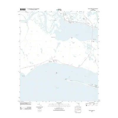
2012 Map of Saint Teresa
USGS Topo · Published 2012About this map
The Ochlockonee River and Sopchoppy River converge here, feeding into the expansive waters of Ochlockonee Bay. Along the coast, small settlements like Surf and Wilson Beach are situated near the mouth of the bay, while the southern peninsula is defined by Alligator Harbor. This coastal landscape is shaped by dynamic shoreline features such as Bay Mouth Bar and Peninsula Point, reflecting the transition between riverine drainage and the open Gulf of Mexico. Local infrastructure includes the Wakulla County Airport and Walker Bridge, which serves as a critical connection across the bay. For those researching local geography, the map identifies numerous small water bodies and points such as Metcalf Lake, Buddy Pond, and Granit Point, providing a detailed view of this Florida panhandle shoreline in the early 21st century.
Find a feature on this map
43 named features on this map. Tap any name to fly to it.
Don’t see what you’re looking for? This feature index may not catch every label — zoom into the map to look around manually.
Map Details
Editions of this 2012 Saint Teresa Map
This is the sole edition of this map. No revisions or reprints were ever made.
Other maps of this area

1940 · Arran
USGS Topo · 1:62,500

1943 · Arran
USGS Topo · 1:62,500

1943 · Dog Island
USGS Topo · 1:31,680

1943 · St. Teresa Beach
USGS Topo · 1:24,000

1943 · Lighthouse Point
USGS Topo · 1:24,000

1945 · Lighthouse Point
USGS Topo · 1:31,680

1945 · Mc Intyre
USGS Topo · 1:31,680

1945 · St Teresa
USGS Topo · 1:31,680

1945 · Sanborn
USGS Topo · 1:31,680

1949 · Apalachicola
USGS Topo · 1:250,000