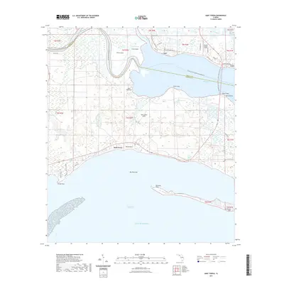
2021 Map of Saint Teresa
USGS Topo · Published 2021About this map
Ochlockonee Bay dominates this coastal landscape where the Ochlockonee River and Sopchoppy River converge before entering the Gulf of Mexico. The settlement of Saint Teresa and the community of Surf sit along the northern shores, connected by a network of local roads such as Co Rd 372 and Alligator Dr. This area is defined by its complex hydrologic features, including Silver Lake, Buddy Pond, and Lefty Bay, alongside prominent landforms like Saint James Island and Mashes Island.
Find a feature on this map
53 named features on this map. Tap any name to fly to it.
Don’t see what you’re looking for? This feature index may not catch every label — zoom into the map to look around manually.
Map Details
Editions of this 2021 Saint Teresa Map
This is the sole edition of this map. No revisions or reprints were ever made.
Other maps of this area

1940 · Arran
USGS Topo · 1:62,500

1943 · Arran
USGS Topo · 1:62,500

1943 · Dog Island
USGS Topo · 1:31,680

1943 · St. Teresa Beach
USGS Topo · 1:24,000

1943 · Lighthouse Point
USGS Topo · 1:24,000

1945 · Lighthouse Point
USGS Topo · 1:31,680

1945 · Mc Intyre
USGS Topo · 1:31,680

1945 · St Teresa
USGS Topo · 1:31,680

1945 · Sanborn
USGS Topo · 1:31,680

1949 · Apalachicola
USGS Topo · 1:250,000