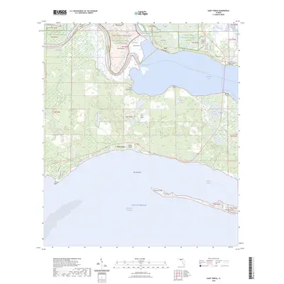
2024 Map of Saint Teresa
USGS Topo · Published 2024About this map
The Saint Marks National Wildlife Refuge and Saint Marks Wilderness dominate the coastal wetlands of this Florida landscape, where the Ochlockonee River and Sopchoppy River converge into Ochlockonee Bay. Along the southern coastline, small settlements like Saint Teresa and Wilson Beach are situated near the protective reach of Alligator Harbor, separated from the open Gulf of Mexico by the narrow strip of Bay Mouth Bar.
Find a feature on this map
59 named features on this map. Tap any name to fly to it.
Don’t see what you’re looking for? This feature index may not catch every label — zoom into the map to look around manually.
Map Details
Editions of this 2024 Saint Teresa Map
This is the sole edition of this map. No revisions or reprints were ever made.
Other maps of this area

1940 · Arran
USGS Topo · 1:62,500

1943 · Arran
USGS Topo · 1:62,500

1943 · Dog Island
USGS Topo · 1:31,680

1943 · St. Teresa Beach
USGS Topo · 1:24,000

1943 · Lighthouse Point
USGS Topo · 1:24,000

1945 · Lighthouse Point
USGS Topo · 1:31,680

1945 · Mc Intyre
USGS Topo · 1:31,680

1945 · St Teresa
USGS Topo · 1:31,680

1945 · Sanborn
USGS Topo · 1:31,680

1949 · Apalachicola
USGS Topo · 1:250,000