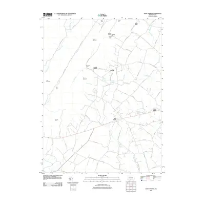
2010 Map of Saint Thomas
USGS Topo · Published 2010About this map
Saint Thomas sits at the heart of this Franklin County landscape, where the valley floor meets the dramatic rise of the Appalachian ridges. This 2010 survey details the transition from the settled lowlands to the steeper elevations of Broad Mountain and Front Mountain. The map highlights historical industrial markers like Franklin Furnace and established communities such as Edenville and Sandy Hook. Significant water features, including Conodoguinet Creek and the Bear Valley Dam, illustrate the drainage patterns of the region, while numerous gaps like Cradle Gap and Hendrix Gap reveal the natural passages used to traverse the ridges. The settlement at Carlton Heights and landmarks like Parnell Knob provide specific points of interest for those studying the local topography and the evolution of the road network, from rural routes like Apple Way to the throughways connecting these mountain-shadowed towns.
Find a feature on this map
69 named features on this map. Tap any name to fly to it.
Don’t see what you’re looking for? This feature index may not catch every label — zoom into the map to look around manually.
Map Details
Editions of this 2010 Saint Thomas Map
This is the sole edition of this map. No revisions or reprints were ever made.
Other maps of this area

1900 · Mercersburg
USGS Topo · 1:62,500

1902 · Chambersburg
USGS Topo · 1:62,500

1902 · Mercersburg
USGS Topo · 1:62,500

1923 · Shippensburg
USGS Topo · 1:62,500

1939 · Orbisonia
USGS Topo · 1:62,500

1940 · Orbisonia
USGS Topo · 1:62,500

1942 · Hagerstown
USGS Topo · 1:125,000

1943 · Hagerstown
USGS Topo · 1:125,000

1943 · Mercersburg
USGS Topo · 1:24,000

1943 · Chambersburg
USGS Topo · 1:62,500
Featured Places
- Metal Township, PA
- Letterkenny Township, PA
- Hamilton Township, PA
- Peters Township, PA
- Sandy Hook, Hamilton Township