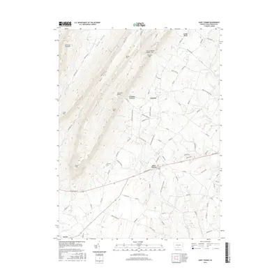
2016 Map of Saint Thomas
USGS Topo · Published 2016About this map
Saint Thomas sits at the intersection of a complex valley system where the Cumberland Valley meets the eastern slopes of the Appalachians. The landscape is defined by long, parallel ridges like Kittatinny Mountain and Front Mtn, creating secluded pockets such as Horse Valley and Bear Valley. A notable historical landmark is Franklin Furnace, hinting at the region's early industrial heritage. The drainage patterns of Conodoguinet Cr and Wilson Run dictate the placement of local roads and older settlements like Markes and Edenville. The presence of distinctive gaps and saddles, including Yankees Gap and Nancys Saddle, illustrates the historical passage points through this varied terrain. At the southern end, Parnell Knob provides a prominent high point overlooking the valley floor, where the road network transitions from mountain passes to the established routes of the lower plains.
Find a feature on this map
80 named features on this map. Tap any name to fly to it.
Don’t see what you’re looking for? This feature index may not catch every label — zoom into the map to look around manually.
Map Details
Editions of this 2016 Saint Thomas Map
This is the sole edition of this map. No revisions or reprints were ever made.
Other maps of this area

1900 · Mercersburg
USGS Topo · 1:62,500

1902 · Chambersburg
USGS Topo · 1:62,500

1902 · Mercersburg
USGS Topo · 1:62,500

1923 · Shippensburg
USGS Topo · 1:62,500

1939 · Orbisonia
USGS Topo · 1:62,500

1940 · Orbisonia
USGS Topo · 1:62,500

1942 · Hagerstown
USGS Topo · 1:125,000

1943 · Hagerstown
USGS Topo · 1:125,000

1943 · Mercersburg
USGS Topo · 1:24,000

1943 · Chambersburg
USGS Topo · 1:62,500
Featured Places
- Metal Township, PA
- Letterkenny Township, PA
- Hamilton Township, PA
- Peters Township, PA
- Sandy Hook, Hamilton Township