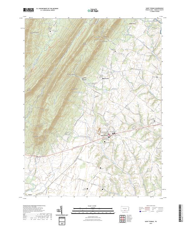
2023 Map of Saint Thomas
USGS Topo · Published 2023About this map
Saint Thomas serves as a central hub in this Franklin County landscape, situated along the historic corridor of Lincoln Way. The map documents a dense concentration of ecclesiastical and genealogical sites, including the Saint Thomas United Brethren Church/Cem and Trinity United Church of Christ Cem. To the north, the terrain transitions sharply into the ridges of Kittatinny Mountain and Broad Mountain, where the industrial history of Franklin Furnace is preserved near the base of Front Mountain.
Find a feature on this map
111 named features on this map. Tap any name to fly to it.
Don’t see what you’re looking for? This feature index may not catch every label — zoom into the map to look around manually.
Map Details
Editions of this 2023 Saint Thomas Map
This is the sole edition of this map. No revisions or reprints were ever made.
Other maps of this area

1900 · Mercersburg
USGS Topo · 1:62,500

1902 · Chambersburg
USGS Topo · 1:62,500

1902 · Mercersburg
USGS Topo · 1:62,500

1923 · Shippensburg
USGS Topo · 1:62,500

1939 · Orbisonia
USGS Topo · 1:62,500

1940 · Orbisonia
USGS Topo · 1:62,500

1942 · Hagerstown
USGS Topo · 1:125,000

1943 · Hagerstown
USGS Topo · 1:125,000

1943 · Mercersburg
USGS Topo · 1:24,000

1943 · Chambersburg
USGS Topo · 1:62,500
Featured Places
- Metal Township, PA
- Letterkenny Township, PA
- Hamilton Township, PA
- Peters Township, PA
- St. Thomas Township, PA