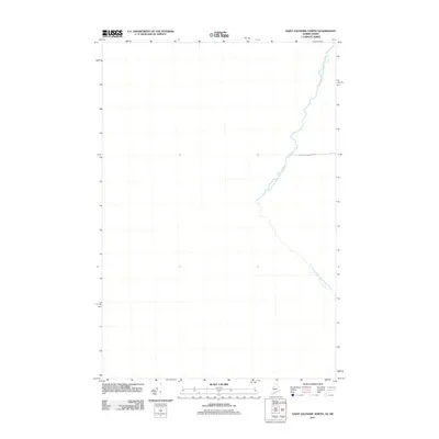
2011 Map of Saint Zacharie North
USGS Topo · Published 2011About this map
The Southwest Branch Saint John River defines the landscape of this borderland region, winding through the timberlands that straddle the international line. This 2011 survey illustrates a sparse wilderness character, dominated by the hydrology of the upper Saint John watershed and the infrastructure of the logging industry. The presence of International Paper Rd underscores the historical and economic importance of commercial forestry in this part of the Maine-Quebec border region. As a remote stretch of territory, the map reveals the intersection of natural river corridors and the private road networks necessary for resource management in the early twenty-first century.
Find a feature on this map
2 named features on this map. Tap any name to fly to it.
Don’t see what you’re looking for? This feature index may not catch every label — zoom into the map to look around manually.
Map Details
Editions of this 2011 Saint Zacharie North Map
This is the sole edition of this map. No revisions or reprints were ever made.
Other maps of this area

1957 · Norris Brook
USGS Topo · 1:62,500

1957 · Hardwood Mountain
USGS Topo · 1:62,500

1957 · Saint Zacharie
USGS Topo · 1:62,500

1962 · Quebec
USGS Topo · 1:250,000
1986 · Lac Etchemin
USGS Topo · 1:100,000
1989 · Hurricane Pond
USGS Topo · 1:24,000
1989 · Black Brook
USGS Topo · 1:24,000
1989 · Hurricane Hill
USGS Topo · 1:24,000
1989 · Hardwood Mountain SW
USGS Topo · 1:24,000
1989 · St. Zacharie North
USGS Topo · 1:24,000