
1957 Map of Saint Zacharie
USGS Topo · Published 1961About this map
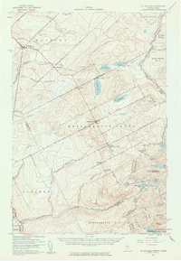
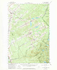
The international boundary between the United States and Canada bisects this 1957 survey, highlighting a shared landscape defined by the upper reaches of the Southwest Branch St John River. On the Quebec side, several small parishes and agricultural settlements like St Zacharie, Ste Aurelie, and St Prosper de Dorchester anchor the road network, which transitions into the heavily timbered interior of Somerset County. The Maine portion of the map is dominated by unorganized townships such as t6 r19 Wels, where human presence is marked by isolated sites like La Croix Depot and a Landing Field. This era of the landscape reveals a heavy reliance on the river systems for geography and industry, with the Metgermette Nord and Metgermette Sud draining the forested highlands. Traces of early industrial activity are visible through scattered Sand or Gravel Pits, while a Dominion Experimental Farm near the border suggests the agricultural development of the region.
Find a feature on this map
53 named features on this map. Tap any name to fly to it.
Don’t see what you’re looking for? This feature index may not catch every label — zoom into the map to look around manually.
Map Details
Editions of this 1957 Saint Zacharie Map
3 editions found
Other maps of this area

1927 · Sandy Bay
USGS Topo · 1:48,000

1930 · Sandy Bay
USGS Topo · 1:62,500

1944 · Sandy Bay
USGS Topo · 1:62,500

1949 · Jackman
USGS Topo · 1:250,000

1956 · Penobscot Lake
USGS Topo · 1:62,500

1957 · Norris Brook
USGS Topo · 1:62,500

1957 · Hardwood Mountain
USGS Topo · 1:62,500

1962 · Quebec
USGS Topo · 1:250,000

1963 · Jackman
USGS Topo · 1:250,000

1966 · Sherbrooke
USGS Topo · 1:250,000