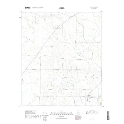
2020 Map of Sale City
USGS Topo · Published 2020About this map
Sale City and the crossroads at Greenough anchor this South Georgia landscape near the border of Mitchell and Colquitt counties. The drainage pattern is defined by the Little Ochlockonee River and Lost Cr, which wind through a terrain marked by distinctive karst features such as Oaky Sinks. This area maintains a strong agricultural and rural character, evidenced by a dense network of local roads including Jerusalem Church Rd and Jackson Dairy Rd. Local history and genealogy researchers will find several significant landmarks, including Shady Grove Cem and Sale City Cem. The presence of Hatcher Lake and various sloughs like Wethington-Slough suggest a low-lying, water-rich environment that has shaped the settlement and transportation routes in this part of Georgia.
Find a feature on this map
56 named features on this map. Tap any name to fly to it.
Don’t see what you’re looking for? This feature index may not catch every label — zoom into the map to look around manually.
Map Details
Editions of this 2020 Sale City Map
This is the sole edition of this map. No revisions or reprints were ever made.
Other maps of this area

1953 · Dothan
USGS Topo · 1:250,000

1953 · Waycross
USGS Topo · 1:250,000

1954 · Dothan
USGS Topo · 1:250,000

1955 · Dothan
USGS Topo · 1:250,000

1956 · Baconton
USGS Topo · 1:62,500

1956 · Doerun
USGS Topo · 1:62,500

1958 · Waycross
USGS Topo · 1:250,000

1971 · Camilla
USGS Topo · 1:24,000

1971 · Cotton
USGS Topo · 1:24,000
1974 · Putney
USGS Topo · 1:24,000