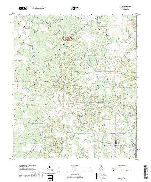
2024 Map of Sale City
USGS Topo · Published 2024About this map
Sale City and Greenough anchor this South Georgia landscape, where a dense network of local roads connects agricultural lands in Mitchell Co. The terrain is defined by its subtle drainage patterns, with the Little Ochlockonee River and Lost Creek flowing southward through the region. Notable landmarks include the Oaky Sinks, a series of depressions that contrast with the surrounding level fields. Local history is documented through the location of the Shady Grove Cem and Sale City Cem, providing essential points of reference for genealogists tracing families in the area. The map illustrates a contemporary rural environment where historic land divisions are still visible in the paths of Jackson Dairy Rd and Stage Coach Rd. Diverse water features, such as Raccoon Creek and Hatcher Lake, further detail the local hydrology and its relation to the community's layout.
Find a feature on this map
57 named features on this map. Tap any name to fly to it.
Don’t see what you’re looking for? This feature index may not catch every label — zoom into the map to look around manually.
Map Details
Editions of this 2024 Sale City Map
This is the sole edition of this map. No revisions or reprints were ever made.
Other maps of this area

1953 · Dothan
USGS Topo · 1:250,000

1953 · Waycross
USGS Topo · 1:250,000

1954 · Dothan
USGS Topo · 1:250,000

1955 · Dothan
USGS Topo · 1:250,000

1956 · Baconton
USGS Topo · 1:62,500

1956 · Doerun
USGS Topo · 1:62,500

1958 · Waycross
USGS Topo · 1:250,000

1971 · Camilla
USGS Topo · 1:24,000

1971 · Cotton
USGS Topo · 1:24,000
1974 · Putney
USGS Topo · 1:24,000