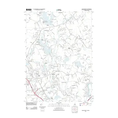
2012 Map of Salem Depot
USGS Topo · Published 2012About this map
Big Island Pond and its numerous residential clusters like Howards Grove and Conleys Grove dominate the northern landscape of this 2012 survey. The area represents a complex transition from these seasonal and lakeside communities to the dense commercial and residential hub of Salem. In the southern portion, the map reveals the intricate neighborhood developments of Graceland Park and Maple Park situated near the regional influence of Southern New Hampshire University at Salem. Local landmarks such as Mystery Hill and the Goddard Airport reflect the area's diverse land use, while water bodies like Arlington Mill Reservoir and Canobie Lake define the suburban layout. This study also documents the precise locations of historical burial grounds, including Mount Pleasant Cem and the Old Cemetery near Atkinson, providing valuable spatial data for local researchers tracing the growth of these Essex County and Rockingham County communities.
Find a feature on this map
364 named features on this map. Tap any name to fly to it.
Don’t see what you’re looking for? This feature index may not catch every label — zoom into the map to look around manually.
Map Details
Editions of this 2012 Salem Depot Map
This is the sole edition of this map. No revisions or reprints were ever made.
Other maps of this area

1886 · Lawrence
USGS Topo · 1:62,500

1886 · Lowell
USGS Topo · 1:62,500

1888 · Haverhill
USGS Topo · 1:62,500

1888 · Lawrence
USGS Topo · 1:62,500

1890 · Haverhill
USGS Topo · 1:62,500

1893 · Lowell
USGS Topo · 1:62,500

1893 · Lawrence
USGS Topo · 1:62,500

1893 · Haverhill
USGS Topo · 1:62,500

1905 · Manchester
USGS Topo · 1:62,500

1918 · Lowell
USGS Topo · 1:62,500