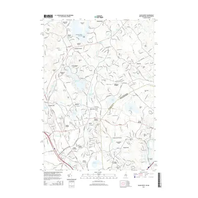
2015 Map of Salem Depot
USGS Topo · Published 2015About this map
Salem Depot and the surrounding residential developments of southern New Hampshire anchor this detailed 2015 study, illustrating the dense suburban expansion of the early 21st century. The map highlights numerous small-scale neighborhoods and grove settlements, such as Conleys Grove, Chases Grove, and Howards Grove, which reflect the area's history as a recreational and lakeside retreat. The terrain is defined by a series of drumlin-like rises, including Zion Hill and Providence Hill, interspersed with an intricate network of water bodies like Canobie Lake and the Spicket River. Notable industrial and agricultural remnants are still visible through features like Hodges Millpond and Providence Hill Mill. For genealogists and local historians, several burial grounds are meticulously documented, including Pine Grove Cem and Hillside Cem, while landmarks like Mystery Hill and Arlington Park provide insight into the region's cultural and tourist landscape.
Find a feature on this map
85 named features on this map. Tap any name to fly to it.
Don’t see what you’re looking for? This feature index may not catch every label — zoom into the map to look around manually.
Map Details
Editions of this 2015 Salem Depot Map
This is the sole edition of this map. No revisions or reprints were ever made.
Other maps of this area

1886 · Lawrence
USGS Topo · 1:62,500

1886 · Lowell
USGS Topo · 1:62,500

1888 · Haverhill
USGS Topo · 1:62,500

1888 · Lawrence
USGS Topo · 1:62,500

1890 · Haverhill
USGS Topo · 1:62,500

1893 · Lowell
USGS Topo · 1:62,500

1893 · Lawrence
USGS Topo · 1:62,500

1893 · Haverhill
USGS Topo · 1:62,500

1905 · Manchester
USGS Topo · 1:62,500

1918 · Lowell
USGS Topo · 1:62,500