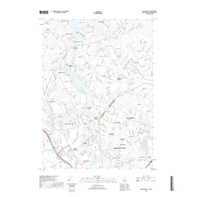
2018 Map of Salem Depot
USGS Topo · Published 2018About this map
Salem and Salem Depot serve as the central hubs of this Rockingham County landscape, where the Boston and Maine RR tracks once anchored the local economy. The terrain is defined by a dense network of glacial ponds and reservoirs, including the expansive Big Island Pond to the north and the Arlington Mill Reservoir at its heart. These water bodies, joined by the Spicket River, shaped the development of clustered summer settlements such as Chases Grove and Conleys Grove.
Find a feature on this map
324 named features on this map. Tap any name to fly to it.
Don’t see what you’re looking for? This feature index may not catch every label — zoom into the map to look around manually.
Map Details
Editions of this 2018 Salem Depot Map
This is the sole edition of this map. No revisions or reprints were ever made.
Other maps of this area

1886 · Lawrence
USGS Topo · 1:62,500

1886 · Lowell
USGS Topo · 1:62,500

1888 · Haverhill
USGS Topo · 1:62,500

1888 · Lawrence
USGS Topo · 1:62,500

1890 · Haverhill
USGS Topo · 1:62,500

1893 · Lowell
USGS Topo · 1:62,500

1893 · Lawrence
USGS Topo · 1:62,500

1893 · Haverhill
USGS Topo · 1:62,500

1905 · Manchester
USGS Topo · 1:62,500

1918 · Lowell
USGS Topo · 1:62,500