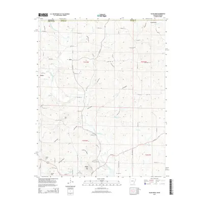
2014 Map of Salem Knob
USGS Topo · Published 2014About this map
Salem Knob and Turkey Knob dominate the local topography of this Fulton County region just south of the Missouri state line. The South Fork Spring River flows through the central terrain, while small-scale agriculture and rural residence patterns are evidenced by family-named landmarks like Wallace Knob and the Hunter Cem. The map captures a transition from the higher elevations in the west toward the water bodies of the east, including Winlake Reservoir and Courtwright Lake. Named settlements such as Moko, Sturkie, and Pine Hill are connected by a network of rural roads like Old Sturkie Rd and Republican Rd. This 2014 survey documents the persistence of these small communities and the continued importance of the river drainage system in shaping the local geography near the Arkansas-Missouri border.
Find a feature on this map
85 named features on this map. Tap any name to fly to it.
Don’t see what you’re looking for? This feature index may not catch every label — zoom into the map to look around manually.
Map Details
Editions of this 2014 Salem Knob Map
This is the sole edition of this map. No revisions or reprints were ever made.
Other maps of this area

1943 · Thayer
USGS Topo · 1:62,500

1944 · West Plains
USGS Topo · 1:62,500

1946 · Thayer
USGS Topo · 1:62,500

1946 · West Plains
USGS Topo · 1:62,500

1950 · Salem
USGS Topo · 1:62,500

1951 · Salem
USGS Topo · 1:62,500

1957 · Poplar Bluff
USGS Topo · 1:250,000

1959 · Poplar Bluff
USGS Topo · 1:250,000

1960 · Poplar Bluff
USGS Topo · 1:250,000

1962 · Agnos
USGS Topo · 1:24,000