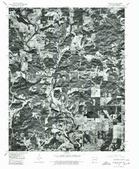
1976 Map of Salem NE
USGS Topo · Published 1977About this map
South Fork Spring River carves a winding path through the borderlands of Arkansas and Missouri, defining the topography of this rural landscape. This 1976 orthophotograph, derived from high-altitude aerial imagery, reveals the complex agricultural patterns and woodlots of Fulton County. The settlement of Moko is visible in the north, while the northern edge of Salem anchors the southern boundary. Unlike a traditional line-drawn map, this aerial perspective captures the exact texture of the land, from the density of the riverbank vegetation to the precise layout of farmsteads and rural roads during the mid-1970s. It provides a unique visual record of land use and property boundaries in a region defined by its waterway and high-relief terrain.
Find a feature on this map
3 named features on this map. Tap any name to fly to it.
Don’t see what you’re looking for? This feature index may not catch every label — zoom into the map to look around manually.
Map Details
Editions of this 1976 Salem NE Map
This is the sole edition of this map. No revisions or reprints were ever made.
Other maps of this area

1943 · Thayer
USGS Topo · 1:62,500

1944 · West Plains
USGS Topo · 1:62,500

1946 · Thayer
USGS Topo · 1:62,500

1946 · West Plains
USGS Topo · 1:62,500

1950 · Salem
USGS Topo · 1:62,500

1951 · Salem
USGS Topo · 1:62,500

1957 · Poplar Bluff
USGS Topo · 1:250,000

1959 · Poplar Bluff
USGS Topo · 1:250,000

1960 · Poplar Bluff
USGS Topo · 1:250,000

1962 · Agnos
USGS Topo · 1:24,000