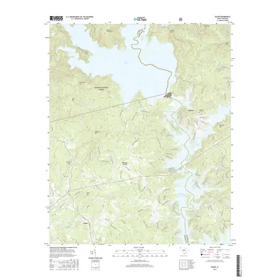
2017 Map of Salem
USGS Topo · Published 2017About this map
Salem serves as the gateway to the Blue Ridge foothills on this modern topographic study, where the town sits at the intersection of rural routes leading north into the Sumter National Forest. The landscape is dominated by the massive impoundments of Lake Jocassee and Lake Keowee, which submerged the deep mountain valleys of the Little River and Boones Creek systems. These reservoirs transformed the region's geography, leaving high points like Fisher Knob and McKinneys Mtn as shoreline landmarks.
Find a feature on this map
133 named features on this map. Tap any name to fly to it.
Don’t see what you’re looking for? This feature index may not catch every label — zoom into the map to look around manually.
Map Details
Editions of this 2017 Salem Map
This is the sole edition of this map. No revisions or reprints were ever made.
Other maps of this area

1886 · Walhalla
USGS Topo · 1:125,000

1888 · Pickens
USGS Topo · 1:125,000

1891 · Cowee
USGS Topo · 1:125,000

1892 · Walhalla
USGS Topo · 1:125,000

1894 · Pickens
USGS Topo · 1:125,000

1896 · Walhalla
USGS Topo · 1:125,000

1897 · Cowee
USGS Topo · 1:125,000

1905 · Pisgah
USGS Topo · 1:125,000

1906 · Pisgah
USGS Topo · 1:125,000

1907 · Cowee
USGS Topo · 1:125,000