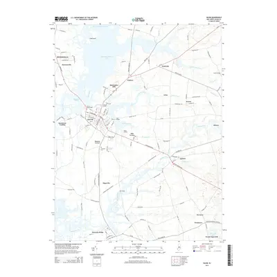
2014 Map of Salem
USGS Topo · Published 2014About this map
Salem serves as the focal point of this region, situated at the confluence of the Salem River and Fenwick Creek. The landscape is defined by its extensive wetlands and water systems, including the Mannington Meadows Lake and the winding Alloway Creek to the south. Historically significant crossings such as the Penns Neck Bridge and Fenwick Bridge connect the residential core with outlying agricultural and industrial sites like Mannington Mills and Pointers. The settlement pattern follows established corridors, branching out to smaller communities such as Quinton, Hancocks Bridge, and Hagerville. Local landmarks like the Salem Airfield and Marlboro Marina reflect a modern economy integrated with the traditional river-front geography, while the Evergreen Cem provides a point of interest for those researching local family history and genealogy in the Salem County area.
Find a feature on this map
127 named features on this map. Tap any name to fly to it.
Don’t see what you’re looking for? This feature index may not catch every label — zoom into the map to look around manually.
Map Details
Editions of this 2014 Salem Map
This is the sole edition of this map. No revisions or reprints were ever made.
Other maps of this area

1890 · Salem
USGS Topo · 1:62,500

1890 · Bay Side
USGS Topo · 1:62,500

1894 · Bay Side
USGS Topo · 1:62,500

1898 · Salem
USGS Topo · 1:62,500

1899 · Vineland
USGS Topo · 1:125,000

1899 · Dover
USGS Topo · 1:125,000

1901 · Camden
USGS Topo · 1:125,000

1904 · Wilmington
USGS Topo · 1:62,500

1906 · Dover
USGS Topo · 1:125,000

1906 · Wilmington
USGS Topo · 1:62,500
Featured Places
- Pennsville Township, NJ
- Salem, NJ
- Quinton Township, NJ
- Lower Alloways Creek Township, NJ
- Alloway Township, NJ