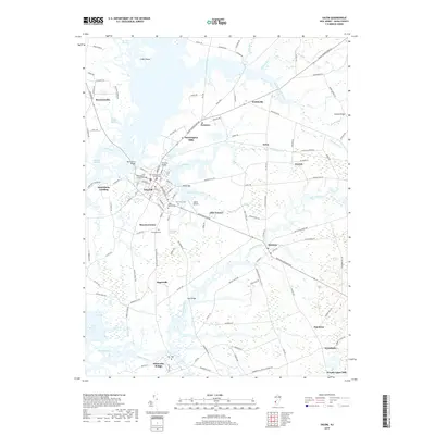
2019 Map of Salem
USGS Topo · Published 2019About this map
The Salem County Courthouse stands as the historic anchor of this South Jersey landscape, where the Salem River and its numerous tidal tributaries define the pattern of settlement. Navigable waterways like Alloway Creek and Fenwick Creek have long shaped the region’s agricultural and industrial identity, from the processing at Mannington Mills to the small village of Hancocks Bridge.
Find a feature on this map
135 named features on this map. Tap any name to fly to it.
Don’t see what you’re looking for? This feature index may not catch every label — zoom into the map to look around manually.
Map Details
Editions of this 2019 Salem Map
This is the sole edition of this map. No revisions or reprints were ever made.
Other maps of this area

1890 · Salem
USGS Topo · 1:62,500

1890 · Bay Side
USGS Topo · 1:62,500

1894 · Bay Side
USGS Topo · 1:62,500

1898 · Salem
USGS Topo · 1:62,500

1899 · Vineland
USGS Topo · 1:125,000

1899 · Dover
USGS Topo · 1:125,000

1901 · Camden
USGS Topo · 1:125,000

1904 · Wilmington
USGS Topo · 1:62,500

1906 · Dover
USGS Topo · 1:125,000

1906 · Wilmington
USGS Topo · 1:62,500
Featured Places
- Pennsville Township, NJ
- Salem, NJ
- Quinton Township, NJ
- Lower Alloways Creek Township, NJ
- Alloway Township, NJ