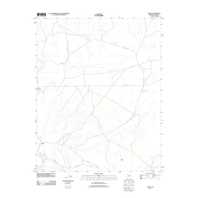
2011 Map of Salina
USGS Topo · Published 2011About this map
Salina and the historic commerce point at Gormons Trading Post anchor this high-desert landscape in the early twenty-first century. The map reveals a network of essential travel corridors, including Bus Route 440 and Indian Rte-251, which facilitate movement through the sparse terrain of the Apache County interior. This road system reflects the importance of connectivity between isolated settlements and traditional trading sites. Water resources, critical in this arid environment, are marked by Salina Springs near the primary settlement. The topography is defined by significant elevations such as White Hill, which overlooks a complex drainage system and the intersecting paths of Indian Rte-4 and Indian Rte-25. This survey provides a precise view of the infrastructure supporting community life within the Chinle Agency's jurisdiction.
Find a feature on this map
12 named features on this map. Tap any name to fly to it.
Don’t see what you’re looking for? This feature index may not catch every label — zoom into the map to look around manually.
Map Details
Editions of this 2011 Salina Map
This is the sole edition of this map. No revisions or reprints were ever made.
Other maps of this area

1886 · Fort Defiance
USGS Topo · 1:250,000

1892 · Fort Defiance
USGS Topo · 1:250,000

1892 · Canyon De Chelly
USGS Topo · 1:250,000

1954 · Shiprock
USGS Topo · 1:250,000

1954 · Gallup
USGS Topo · 1:250,000

1958 · Gallup
USGS Topo · 1:250,000

1958 · Shiprock
USGS Topo · 1:250,000

1959 · Shiprock
USGS Topo · 1:250,000

1959 · Gallup
USGS Topo · 1:250,000

1962 · Gallup
USGS Topo · 1:250,000