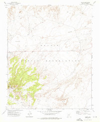
1972 Map of Salina
USGS Topo · Published 1976About this map
Salina Springs and the nearby settlement of Salina are the primary points of human presence in this high-desert portion of the Navajo Indian Reservation. The terrain is characterized by the complex drainage systems of Cottonwood Wash and Tse Bit Ni Zi Ni Wash, which reveal the deep seasonal water pathways across the landscape. The inclusion of Bitterwater Well highlights the vital importance of scattered water sources in this environment, while White Hill stands out as a significant topographical landmark. This 1970s survey captures the region's sparse infrastructure and remote character during a period when many traditional routes were first being formally documented by the USGS through modern photogrammetric methods.
Find a feature on this map
7 named features on this map. Tap any name to fly to it.
Don’t see what you’re looking for? This feature index may not catch every label — zoom into the map to look around manually.
Map Details
Editions of this 1972 Salina Map
This is the sole edition of this map. No revisions or reprints were ever made.
Other maps of this area

1886 · Fort Defiance
USGS Topo · 1:250,000

1892 · Fort Defiance
USGS Topo · 1:250,000

1892 · Canyon De Chelly
USGS Topo · 1:250,000

1954 · Shiprock
USGS Topo · 1:250,000

1954 · Gallup
USGS Topo · 1:250,000

1958 · Gallup
USGS Topo · 1:250,000

1958 · Shiprock
USGS Topo · 1:250,000

1959 · Shiprock
USGS Topo · 1:250,000

1959 · Gallup
USGS Topo · 1:250,000

1962 · Gallup
USGS Topo · 1:250,000