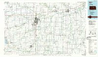
1985 Map of Salina
USGS Topo · Published 1985About this map
The Saline River, Solomon River, and Smoky Hill River converge in this central Kansas landscape, where the grain-handling hub of Salina dominates the intersection of major transport corridors. The map highlights the intensive rail network of the mid-1980s, including the Union Pacific, Santa Fe, and Missouri Pacific lines that served the region's agricultural economy. Beyond the city center, the terrain is defined by the Smoky Hills and significant public landmarks such as Bethany College in Lindsborg and the expansive Smoky Hill Air Force Range to the west.
Find a feature on this map
67 named features on this map. Tap any name to fly to it.
Don’t see what you’re looking for? This feature index may not catch every label — zoom into the map to look around manually.
Map Details
Editions of this 1985 Salina Map
This is the sole edition of this map. No revisions or reprints were ever made.
Other maps of this area

1886 · Junction City
USGS Topo · 1:125,000

1889 · Newton
USGS Topo · 1:125,000

1889 · Junction City
USGS Topo · 1:125,000

1889 · Abilene
USGS Topo · 1:125,000

1889 · Parkerville
USGS Topo · 1:125,000

1891 · Hutchinson
USGS Topo · 1:125,000

1891 · Clay Center
USGS Topo · 1:125,000

1892 · Salina
USGS Topo · 1:125,000

1892 · Minneapolis
USGS Topo · 1:125,000

1893 · Hutchinson
USGS Topo · 1:125,000