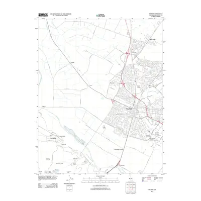
2012 Map of Salinas
USGS Topo · Published 2012About this map
Salinas serves as the focal point of this 2012 survey, revealing the dense urban grid and surrounding agricultural landscape of Monterey County. The map documents the sprawling residential developments of Santa Rita and Bolsa Knolls to the north, while the Salinas River carves a path through the valley floor to the south. Distinct cultural and institutional footprints are visible, including the California Rodeo Grounds and several specialized burial sites such as the Chinese Cem and the Independent Order of Odd Fellows Cem.
Find a feature on this map
106 named features on this map. Tap any name to fly to it.
Don’t see what you’re looking for? This feature index may not catch every label — zoom into the map to look around manually.
Map Details
Editions of this 2012 Salinas Map
This is the sole edition of this map. No revisions or reprints were ever made.
Other maps of this area

1910 · Salinas
USGS Topo · 1:31,680

1912 · Salinas
USGS Topo · 1:62,500

1912 · Capitola
USGS Topo · 1:62,500

1913 · Monterey
USGS Topo · 1:62,500

1914 · Capitola
USGS Topo · 1:62,500

1915 · San Juan Bautista
USGS Topo · 1:48,000

1917 · San Juan Bautista
USGS Topo · 1:62,500

1939 · San Juan Bautista
USGS Topo · 1:62,500

1940 · San Juan Bautista
USGS Topo · 1:62,500

1940 · Salinas
USGS Topo · 1:62,500