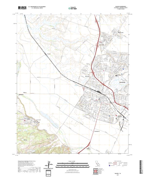
2021 Map of Salinas
USGS Topo · Published 2021About this map
Salinas stands as a central hub for the Monterey County agricultural corridor, anchored by the winding course of the Salinas River and its accompanying sloughs. This 2021 study details the complex network of drainage and development, from the Tembladero Slough in the northwest to the Alisal Slough and Natividad Cr that thread through the city's eastern expansion. The map serves as a vital record for genealogists and local historians, featuring several distinct burial grounds including the Chinese Cem, Yamato Cem, and the Monterey County Potters Field Cem. To the south, the landscape shifts from the dense urban grid of Hartnell Community College and the Monterey County Superior Court Salinas toward the southern ridges. Here, one finds East Garrison and the training grounds of Machine Gun Flats, situated just north of the prominent Sandstone Ridge and Pilarcitos Ridge.
Find a feature on this map
243 named features on this map. Tap any name to fly to it.
Don’t see what you’re looking for? This feature index may not catch every label — zoom into the map to look around manually.
Map Details
Editions of this 2021 Salinas Map
This is the sole edition of this map. No revisions or reprints were ever made.
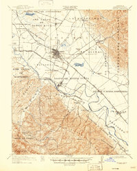
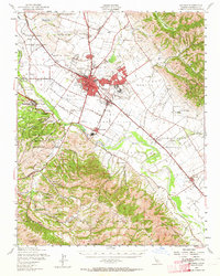
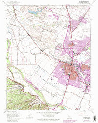
Historical Maps of Toro Camp Through Time
6 maps found