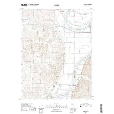
2017 Map of Saline City
USGS Topo · Published 2017About this map
Saline City sits at the heart of this central Missouri landscape, where the shifting currents of the Missouri River define the boundaries of Saline, Chariton, and Howard counties. The river's influence is evident in the intricate shoreline features, including Epperson Island and several dramatic turns such as Fish Creek Bend and Euphrasie Bend. This topography reflects a late 2010s perspective on a historic agricultural and riverine corridor, where small settlements like Gilliam and West Glasgow serve as anchors for the surrounding rural sections. Local history is preserved in several burial grounds scattered across the terrain, including Sappington Cem, All Saints Cem, and Gilliam Cem. Notable water bodies such as Slater Pond and Turtle Lake dot the uplands and bottomlands, while a complex network of creeks like Fish Creek and Pierre Fleche Creek drain the fertile land toward the great river.
Find a feature on this map
62 named features on this map. Tap any name to fly to it.
Don’t see what you’re looking for? This feature index may not catch every label — zoom into the map to look around manually.
Map Details
Editions of this 2017 Saline City Map
This is the sole edition of this map. No revisions or reprints were ever made.
Other maps of this area

1890 · Glasgow
USGS Topo · 1:125,000

1890 · Marshall
USGS Topo · 1:125,000

1892 · Marshall
USGS Topo · 1:125,000

1901 · Marshall
USGS Topo · 1:125,000

1940 · Marshall
USGS Topo · 1:62,500

1944 · Marshall
USGS Topo · 1:62,500

1947 · Glasgow
USGS Topo · 1:62,500
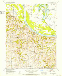
1951 · New Frankfort
USGS Topo · 1:24,000

1953 · Moberly
USGS Topo · 1:250,000

1954 · Moberly
USGS Topo · 1:250,000