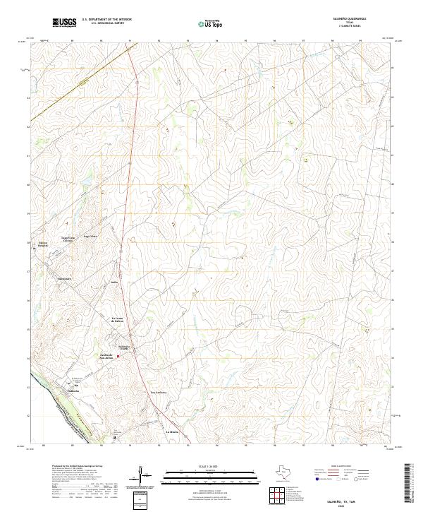
2022 Map of Salineno
USGS Topo · Published 2022About this map
The Rio Grande serves as the international boundary between the United States of America and Mexico in this South Texas borderland. The landscape is defined by a series of residential clusters and colonias situated along the river and North Grant Street, including Salineño, Falcon Heights, and Lago Vista Colonia. These communities are connected by a network of local roads like the Salineño Road and Placido Road, which navigate around drainage features such as Arroyo Morteros and Arroyo la Minita.
Find a feature on this map
44 named features on this map. Tap any name to fly to it.
Don’t see what you’re looking for? This feature index may not catch every label — zoom into the map to look around manually.
Map Details
Editions of this 2022 Salineno Map
This is the sole edition of this map. No revisions or reprints were ever made.
Other maps of this area

1938 · Falcon
USGS Topo · 1:62,500

1938 · El Sauz
USGS Topo · 1:62,500

1949 · Mc Allen
USGS Topo · 1:250,000

1954 · McAllen
USGS Topo · 1:250,000

1956 · Escobares
USGS Topo · 1:62,500

1956 · Roma
USGS Topo · 1:62,500

1957 · Mc Allen
USGS Topo · 1:250,000

1962 · McAllen
USGS Topo · 1:250,000

1965 · Salineno
USGS Topo · 1:24,000
1965 · Falcon Village
USGS Topo · 1:24,000
Featured Places
- Falconaire Colonia, TX
- Indio Number 1 Colonia, TX
- Indio Number 2 Colonia, TX
- Lago Vista Colonia, TX
- Jardin de San Julian Colonia, TX