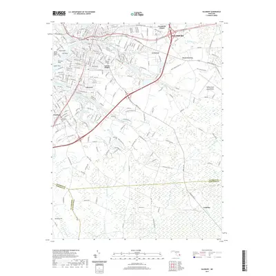
2019 Map of Salisbury
USGS Topo · Published 2019About this map
The Wicomico River and its complex network of prongs and creeks define the landscape of this Delmarva region in 2019. The city of Salisbury serves as a central hub, with established neighborhoods like Chesapeake Heights, Lincoln Heights, and Lakewood spreading outward from the riverbanks. To the south, the city of Fruitland maintains its own distinct footprint, while the Salisbury-Ocean City Wicomico Regional Airport anchors the eastern edge of the survey area.
Find a feature on this map
235 named features on this map. Tap any name to fly to it.
Don’t see what you’re looking for? This feature index may not catch every label — zoom into the map to look around manually.
Map Details
Editions of this 2019 Salisbury Map
This is the sole edition of this map. No revisions or reprints were ever made.
Other maps of this area

1901 · Snow Hill
USGS Topo · 1:62,500

1901 · Salisbury
USGS Topo · 1:62,500

1902 · Pittsville
USGS Topo · 1:62,500

1942 · Princess Anne
USGS Topo · 1:24,000

1942 · Snow Hill
USGS Topo · 1:24,000

1942 · Eden
USGS Topo · 1:24,000

1942 · Wango
USGS Topo · 1:24,000

1942 · Hebron
USGS Topo · 1:24,000

1942 · Dividing Creek
USGS Topo · 1:24,000

1942 · Salisbury
USGS Topo · 1:24,000