2023 Map of Salisbury
USGS Topo · Published 2023About this map
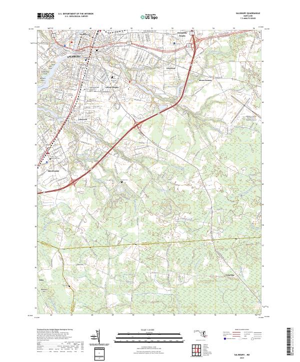
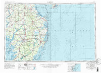
The Wicomico County Courthouse stands as the central landmark of Salisbury, Maryland, in this contemporary survey of the Delmarva Peninsula's urban hub. The landscape is defined by the convergence of the North Prong Wicomico River and the main Wicomico River, where maritime points like Nancy Point and Owl Point mark the transition toward the Chesapeake. To the south, the city gives way to the communities of Fruitland and Eden, while the eastern extent is characterized by residential pockets like Chesapeake Heights and Mount Hermon.
Find a feature on this map
60 named features on this map. Tap any name to fly to it.
Don’t see what you’re looking for? This feature index may not catch every label — zoom into the map to look around manually.
Map Details
Editions of this 2023 Salisbury Map
This is the sole edition of this map. No revisions or reprints were ever made.
Historical Maps of Quail Ridge Through Time
12 maps found
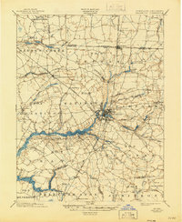
1901 Salisbury
Wicomico County, MD
1942 Salisbury
Wicomico County, MD
1943 Salisbury
Wicomico County, MD
1946 Salisbury
Wicomico County, MD

1947 Salisbury
Wicomico County, MD

1948 Salisbury
Wicomico County, MD

1957 Salisbury
Wicomico County, MD

1961 Salisbury
Wicomico County, MD

1965 Salisbury
Wicomico County, MD
1982 Salisbury
Wicomico County, MD

1983 Salisbury
Wicomico County, MD
2023 Salisbury
Wicomico County, MD