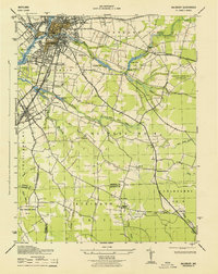
1943 Map of Salisbury
USGS Topo · Published 1943About this map
Salisbury anchors this coastal plain landscape, which shows a transition from urban development to a network of creeks and small farming outposts during the early 1940s. The city's geography is defined by the Wicomico River and industrial infrastructure, including the Pennsylvania Railroad and the expanding Salisbury Airport No 2. Social landmarks like the Wicomico Orphanage and Wicomico Memorial Park provide specific points for local historians and genealogists. Moving south toward Fruitland, the terrain becomes more rural, punctuated by a series of ponds like Schumaker Pond and Tonytank Pond. The southern reaches of the quadrangle are characterized by distinct civil districts like Nutters No 8 and Atkinson No 7, where community life centered around places such as Nassawango Church and St Lukes. Numerous family-named water features, such as Widow Hawkins Branch, suggest the deep-rooted landownership patterns of the era.
Find a feature on this map
45 named features on this map. Tap any name to fly to it.
Don’t see what you’re looking for? This feature index may not catch every label — zoom into the map to look around manually.
Map Details
Editions of this 1943 Salisbury Map
This is the sole edition of this map. No revisions or reprints were ever made.
Other maps of this area

1901 · Snow Hill
USGS Topo · 1:62,500

1901 · Salisbury
USGS Topo · 1:62,500

1902 · Pittsville
USGS Topo · 1:62,500

1942 · Princess Anne
USGS Topo · 1:24,000

1942 · Snow Hill
USGS Topo · 1:24,000

1942 · Eden
USGS Topo · 1:24,000

1942 · Wango
USGS Topo · 1:24,000

1942 · Hebron
USGS Topo · 1:24,000

1942 · Dividing Creek
USGS Topo · 1:24,000

1942 · Salisbury
USGS Topo · 1:24,000