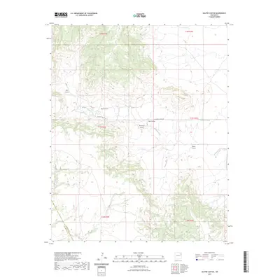
2023 Map of Salitre Canyon
USGS Topo · Published 2023About this map
Salitre Canyon and its network of drainage systems define the rugged high plains of the Harding and San Miguel County border. This landscape is characterized by deep erosional features including Vigas Canyon, Ojos Canyon, and Tapia Canyon, which carve through the plateau towards the eastern plains. Water is the primary architect here, with Mosquero Creek and Atarque Creek serving as the principal hydrologic arteries across the townships.
Find a feature on this map
16 named features on this map. Tap any name to fly to it.
Don’t see what you’re looking for? This feature index may not catch every label — zoom into the map to look around manually.
Map Details
Editions of this 2023 Salitre Canyon Map
This is the sole edition of this map. No revisions or reprints were ever made.
Other maps of this area

1954 · Tucumcari
USGS Topo · 1:250,000

1958 · Tucumcari
USGS Topo · 1:250,000

1969 · Gallegos
USGS Topo · 1:24,000

1969 · Salitre Canyon
USGS Topo · 1:24,000
1969 · Alamosa Canyon
USGS Topo · 1:24,000
1969 · Campana
USGS Topo · 1:24,000

1969 · Chinaberry Canyon
USGS Topo · 1:24,000

1969 · Buffalo Springs
USGS Topo · 1:24,000

1973 · Circle Bar Ranch
USGS Topo · 1:24,000

1973 · Mosquero
USGS Topo · 1:24,000