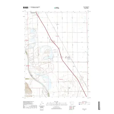
2018 Map of Salix
USGS Topo · Published 2018About this map
The Missouri River floodplain south of Sioux City defines this 2018 survey, where the river channel serves as the shifting boundary between Iowa and Nebraska. The small community of Salix sits positioned between the river's backwaters and the fertile agricultural plains to the east. The landscape is a mix of managed water systems like the Farmers Canal and natural features such as Browns Lake, reflecting a long history of flood control and land reclamation along the Missouri’s edge.
Find a feature on this map
58 named features on this map. Tap any name to fly to it.
Don’t see what you’re looking for? This feature index may not catch every label — zoom into the map to look around manually.
Map Details
Editions of this 2018 Salix Map
This is the sole edition of this map. No revisions or reprints were ever made.
Other maps of this area

1955 · Sioux City
USGS Topo · 1:250,000

1958 · Sioux City
USGS Topo · 1:250,000

1959 · Sioux City
USGS Topo · 1:250,000

1963 · Sioux City South
USGS Topo · 1:24,000

1964 · Sergeant Bluff
USGS Topo · 1:24,000

1964 · Lawton
USGS Topo · 1:24,000

1964 · Luton
USGS Topo · 1:24,000

1964 · Homer
USGS Topo · 1:24,000

1964 · Salix
USGS Topo · 1:24,000

1966 · Walthill
USGS Topo · 1:24,000