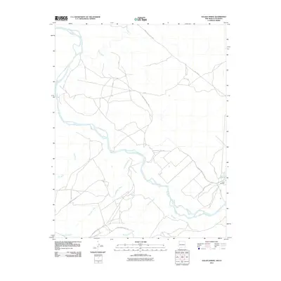
2010 Map of Sallies Spring
USGS Topo · Published 2010About this map
The San Juan River carves a winding path across this landscape, serving as the primary hydrological feature where it meets tributaries like the Mancos River and Salt Wash. This region near the border of New Mexico and Colorado is defined by its drainage systems, including the long reaches of Shoe Game Wash and Beclabito Wash. A network of utility and administrative roads, such as Indian Service Route 5029 and Pipe Line Rd, provides the essential infrastructure through the open country. To the southeast, the presence of an Area Silt Dam indicates active land management efforts to control sediment flow in an area marked by Rough Terrain. The map reveals a land structured by water rights and access, where seasonal washes like Red Wash dictate the movement and settlement patterns in this part of the Shiprock Agency.
Find a feature on this map
15 named features on this map. Tap any name to fly to it.
Don’t see what you’re looking for? This feature index may not catch every label — zoom into the map to look around manually.
Map Details
Editions of this 2010 Sallies Spring Map
This is the sole edition of this map. No revisions or reprints were ever made.
Other maps of this area

1886 · Abajo
USGS Topo · 1:250,000

1889 · Chaco
USGS Topo · 1:250,000

1892 · Abajo
USGS Topo · 1:250,000

1892 · Chaco
USGS Topo · 1:250,000

1892 · Canyon De Chelly
USGS Topo · 1:250,000

1893 · Abajo
USGS Topo · 1:250,000

1934 · Rattlesnake
USGS Topo · 1:62,500

1937 · Rattlesnake
USGS Topo · 1:62,500

1953 · Pastora Peak NE
USGS Topo · 1:24,000

1953 · Pastora Peak SE
USGS Topo · 1:24,000