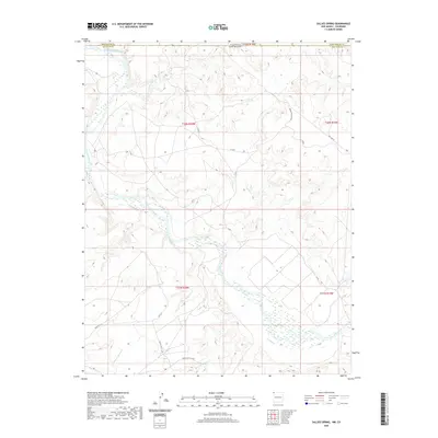
2020 Map of Sallies Spring
USGS Topo · Published 2020About this map
The San Juan River and its major tributaries dominate this high-desert landscape along the border of New Mexico and Colorado. The confluence with the Mancos River marks a primary hydrological junction in the northern sector, while the broad, braided channels of Salt Wash, Shoe Game Wash, and Red Wash cut deep drainage patterns into the terrain. This desert environment is interlaced with a network of service roads and infrastructure corridors, including Indian Svc Rte 5029 and Pipe Line Rd, which support the regional energy and transportation needs. The map meticulously documents the transition between San Juan County, New Mexico, and Montezuma County, Colorado, illustrating how ephemeral waterways like Beclabito Wash define the physical geography of this arid borderland.
Find a feature on this map
20 named features on this map. Tap any name to fly to it.
Don’t see what you’re looking for? This feature index may not catch every label — zoom into the map to look around manually.
Map Details
Editions of this 2020 Sallies Spring Map
This is the sole edition of this map. No revisions or reprints were ever made.
Other maps of this area

1886 · Abajo
USGS Topo · 1:250,000

1889 · Chaco
USGS Topo · 1:250,000

1892 · Abajo
USGS Topo · 1:250,000

1892 · Chaco
USGS Topo · 1:250,000

1892 · Canyon De Chelly
USGS Topo · 1:250,000

1893 · Abajo
USGS Topo · 1:250,000

1934 · Rattlesnake
USGS Topo · 1:62,500

1937 · Rattlesnake
USGS Topo · 1:62,500

1953 · Pastora Peak NE
USGS Topo · 1:24,000

1953 · Pastora Peak SE
USGS Topo · 1:24,000