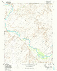
1983 Map of Sallies Spring
USGS Topo · Published 1984About this map
The San Juan River carves a deep path through the high desert of the Four Corners region, defining the complex intersection of the Colorado-New Mexico state line and the borders of the Ute Mountain Indian Reservation and Navajo Indian Reservation. This 1980s landscape is largely defined by its drainage systems, including the Mancos River and several prominent washes such as Salt Wash, Game Wash, and Beclabito Wash that feed into the main river channel.
Find a feature on this map
16 named features on this map. Tap any name to fly to it.
Don’t see what you’re looking for? This feature index may not catch every label — zoom into the map to look around manually.
Map Details
Editions of this 1983 Sallies Spring Map
This is the sole edition of this map. No revisions or reprints were ever made.
Other maps of this area

1886 · Abajo
USGS Topo · 1:250,000

1889 · Chaco
USGS Topo · 1:250,000

1892 · Abajo
USGS Topo · 1:250,000

1892 · Chaco
USGS Topo · 1:250,000

1892 · Canyon De Chelly
USGS Topo · 1:250,000

1893 · Abajo
USGS Topo · 1:250,000

1934 · Rattlesnake
USGS Topo · 1:62,500

1937 · Rattlesnake
USGS Topo · 1:62,500

1953 · Pastora Peak NE
USGS Topo · 1:24,000

1953 · Pastora Peak SE
USGS Topo · 1:24,000