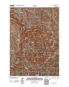
2011 Map of Salmon Fork
USGS Topo · Published 2011About this map
Thirtymile Creek and its tributary, the Salmon Fork Thirtymile Creek, carve through this Wheeler County landscape, defining a network of deep canyons and high ridges. The map shows a region shaped by grazing and rural infrastructure, centered around the small settlements of Edwards and Stewarts. A notable aviation landmark, the Kinzua General Aviation Recreational Airport, sits in the southern portion of the sheet near Gun Club Canyon.
Find a feature on this map
24 named features on this map. Tap any name to fly to it.
Don’t see what you’re looking for? This feature index may not catch every label — zoom into the map to look around manually.
Map Details
Editions of this 2011 Salmon Fork Map
This is the sole edition of this map. No revisions or reprints were ever made.
Other maps of this area

1916 · Condon
USGS Topo · 1:125,000

1926 · Mitchell
USGS Topo · 1:125,000

1953 · Spray
USGS Topo · 1:62,500

1953 · Pendleton
USGS Topo · 1:250,000

1953 · The Dalles
USGS Topo · 1:250,000

1955 · Bend
USGS Topo · 1:250,000

1955 · Canyon City
USGS Topo · 1:250,000

1956 · The Dalles
USGS Topo · 1:250,000

1956 · Pendleton
USGS Topo · 1:250,000

1957 · Bend
USGS Topo · 1:250,000