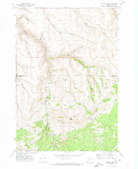
1970 Map of Salmon Fork
USGS Topo · Published 1973About this map
Salmon Fork winds through a complex system of drainages along the Gilliam Co and Wheeler Co line in north-central Oregon. This 1970 field check documents a landscape defined by ranching and timber infrastructure, including the Kinzua and Southern rail line and the Kinzua Landing Strip. The presence of the Trail Fork School and scattered Graves suggests a dispersed community of residents tied to the surrounding canyons. Small settlements like Edwards and Stewarts appear alongside recreational and industrial landmarks, such as the Kinzua Golf Course and several labeled Borrow Pit locations. The terrain is marked by distinct geological features like Steamboat Rock, Squaw Butte, and deep-cut ravines including Papersack Canyon and Thirty Mile Canyon. Numerous Springs and Spring points are recorded throughout the uplands, indicating vital water sources for the remote holdings found at the turn of the 1970s.
Find a feature on this map
30 named features on this map. Tap any name to fly to it.
Don’t see what you’re looking for? This feature index may not catch every label — zoom into the map to look around manually.
Map Details
Editions of this 1970 Salmon Fork Map
This is the sole edition of this map. No revisions or reprints were ever made.
Other maps of this area

1916 · Condon
USGS Topo · 1:125,000

1926 · Mitchell
USGS Topo · 1:125,000

1953 · Spray
USGS Topo · 1:62,500

1953 · Pendleton
USGS Topo · 1:250,000

1953 · The Dalles
USGS Topo · 1:250,000

1955 · Bend
USGS Topo · 1:250,000

1955 · Canyon City
USGS Topo · 1:250,000

1956 · The Dalles
USGS Topo · 1:250,000

1956 · Pendleton
USGS Topo · 1:250,000

1957 · Bend
USGS Topo · 1:250,000