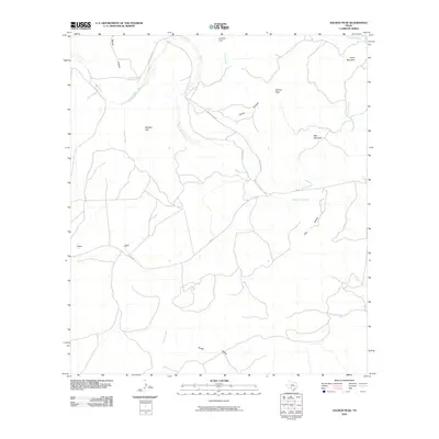
2010 Map of Salmon Peak
USGS Topo · Published 2010About this map
Salmon Peak serves as a central landmark in this portion of Kinney County, presiding over a landscape defined by deep draws and complex drainage patterns. The West Nueces River carves through the northern reaches, joined by numerous tributaries including Nueces Creek and Chalk Creek. This 2010 survey illustrates a sparsely populated ranching region where local geography is marked by distinctive crossings and landmarks like Soldiers Gap and Grass Valley.
Find a feature on this map
22 named features on this map. Tap any name to fly to it.
Don’t see what you’re looking for? This feature index may not catch every label — zoom into the map to look around manually.
Map Details
Editions of this 2010 Salmon Peak Map
This is the sole edition of this map. No revisions or reprints were ever made.
Other maps of this area

1893 · Nueces
USGS Topo · 1:125,000

1896 · Nueces
USGS Topo · 1:125,000

1896 · Brackett
USGS Topo · 1:125,000

1897 · Brackett
USGS Topo · 1:125,000

1938 · Turkey Mountain
USGS Topo · 1:48,000

1943 · Turkey Mountain
USGS Topo · 1:62,500

1944 · Barksdale
USGS Topo · 1:62,500

1944 · Brackettville
USGS Topo · 1:62,500

1944 · Indian Mountain
USGS Topo · 1:62,500

1958 · Del Rio
USGS Topo · 1:250,000