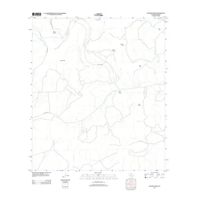
2013 Map of Salmon Peak
USGS Topo · Published 2013About this map
Salmon Peak serves as a prominent landmark in this Kinney County landscape, where the drainage systems of the W Nueces River and various creeks carve through the plateau. The map details a network of dry-land drainages and canyons, including Cañon Grande, Miguel Canyon, and Dick Hollow, which illustrate the complex topography of the Edwards Plateau region. Transportation across this sparsely populated terrain is anchored by Ranch Road 334 and Farm-To-Market Road 3199, connecting remote landmarks like Soldiers Gap and Sycamore Springs. The intersection of names like Loma la Cruz and Pear Mtn reflects the cultural history and physical geography of the Texas borderlands. Water sources, vital in this arid environment, are mapped through features such as Arenosa Cr and French Cr.
Find a feature on this map
22 named features on this map. Tap any name to fly to it.
Don’t see what you’re looking for? This feature index may not catch every label — zoom into the map to look around manually.
Map Details
Editions of this 2013 Salmon Peak Map
This is the sole edition of this map. No revisions or reprints were ever made.
Other maps of this area

1893 · Nueces
USGS Topo · 1:125,000

1896 · Nueces
USGS Topo · 1:125,000

1896 · Brackett
USGS Topo · 1:125,000

1897 · Brackett
USGS Topo · 1:125,000

1938 · Turkey Mountain
USGS Topo · 1:48,000

1943 · Turkey Mountain
USGS Topo · 1:62,500

1944 · Barksdale
USGS Topo · 1:62,500

1944 · Brackettville
USGS Topo · 1:62,500

1944 · Indian Mountain
USGS Topo · 1:62,500

1958 · Del Rio
USGS Topo · 1:250,000