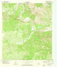
1974 Map of Salmon Peak
USGS Topo · Published 1977About this map
Salmon Peak and Pear Mountain dominate this landscape in Kinney County, where the high Edwards Plateau breaks toward the Rio Grande plain. The winding course of the West Nueces River carves a deep valley through the terrain, joined by seasonal drainages like Chalk Creek and Nueces Creek. This 1970s survey captures a ranching environment defined by wide open spaces such as Grass Valley and isolated landmarks like Loma La Cruz. Evidence of local history and land use is scattered across the quadrangle, from a small Cem near the river to a remote Gaging Sta and various Wells that suggest the critical importance of water management in this semi-arid region. The presence of numerous Jeep Trails and the historic Tularosa Road indicates a network of accessibility through the gaps and canyons of the Balcones Escarpment.
Find a feature on this map
30 named features on this map. Tap any name to fly to it.
Don’t see what you’re looking for? This feature index may not catch every label — zoom into the map to look around manually.
Map Details
Editions of this 1974 Salmon Peak Map
This is the sole edition of this map. No revisions or reprints were ever made.
Other maps of this area

1893 · Nueces
USGS Topo · 1:125,000

1896 · Nueces
USGS Topo · 1:125,000

1896 · Brackett
USGS Topo · 1:125,000

1897 · Brackett
USGS Topo · 1:125,000

1938 · Turkey Mountain
USGS Topo · 1:48,000

1943 · Turkey Mountain
USGS Topo · 1:62,500

1944 · Barksdale
USGS Topo · 1:62,500

1944 · Brackettville
USGS Topo · 1:62,500

1944 · Indian Mountain
USGS Topo · 1:62,500

1958 · Del Rio
USGS Topo · 1:250,000