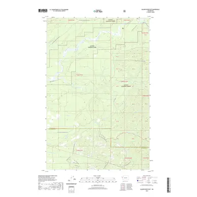
2020 Map of Salmon River East
USGS Topo · Published 2020About this map
The Queets River and Salmon River dominate this Olympic Peninsula landscape, where managed timberlands meet protected wilderness. The boundary between Olympic National Park and Olympic National Forest runs through the center of the sheet, illustrating the transition from recreational forest land to high-protection park territory. The intricate drainage network of Matheny Creek, Phelan Cr, and Mud Cr feeds into these major river systems, while the prominent Matheny Ridge rises to the east. Transportation in this area is defined by a network of logging and access roads, including Natl Forest Develop Road 3300 Rd and Queets River Rd, alongside primitive routes like the Sams River Loop Trail. This map captures a corner of the Pacific Northwest where industrial forestry and natural conservation coexist at the confluence of several vital salmon-bearing forks.
Find a feature on this map
48 named features on this map. Tap any name to fly to it.
Don’t see what you’re looking for? This feature index may not catch every label — zoom into the map to look around manually.
Map Details
Editions of this 2020 Salmon River East Map
This is the sole edition of this map. No revisions or reprints were ever made.
Other maps of this area

1921 · Quinault Lake
USGS Topo · 1:62,500

1943 · Copalis Beach
USGS Topo · 1:250,000

1951 · Copalis Beach
USGS Topo · 1:250,000

1955 · Macafee Hill
USGS Topo · 1:62,500

1955 · Quinault Lake
USGS Topo · 1:62,500

1956 · Kloochman Rock
USGS Topo · 1:62,500

1956 · Salmon River
USGS Topo · 1:62,500

1957 · Copalis Beach
USGS Topo · 1:250,000

1958 · Seattle
USGS Topo · 1:250,000

1962 · Seattle
USGS Topo · 1:250,000