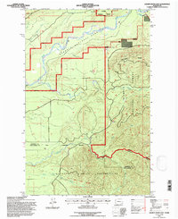
1995 Map of Salmon River East
USGS Topo · Published 1997About this map
The Quinault Indian Reservation and Olympic National Park meet in this 1990s U.S. Forest Service revision, illustrating a complex landscape of jurisdictional boundaries and drainage systems. The survey highlights the Old Indian Treaty Boundary as it intersects with the Queets River and the rugged Matheny Ridge. This area is defined by its hydrology, with the North Fork Salmon River and numerous tributaries like Matheny Creek and Phelan Creek carving through the terrain. Evidence of land use and resource extraction appears in the form of scattered Borrow Pits and a Gravel Pit, providing a grounded record of local infrastructure needs during the late twentieth century. The map serves as a primary source for understanding the precise alignment of the National Forest Boundary against both tribal and park lands.
Find a feature on this map
25 named features on this map. Tap any name to fly to it.
Don’t see what you’re looking for? This feature index may not catch every label — zoom into the map to look around manually.
Map Details
Editions of this 1995 Salmon River East Map
This is the sole edition of this map. No revisions or reprints were ever made.
Other maps of this area

1921 · Quinault Lake
USGS Topo · 1:62,500

1943 · Copalis Beach
USGS Topo · 1:250,000

1951 · Copalis Beach
USGS Topo · 1:250,000

1955 · Macafee Hill
USGS Topo · 1:62,500

1955 · Quinault Lake
USGS Topo · 1:62,500

1956 · Kloochman Rock
USGS Topo · 1:62,500

1956 · Salmon River
USGS Topo · 1:62,500

1957 · Copalis Beach
USGS Topo · 1:250,000

1958 · Seattle
USGS Topo · 1:250,000

1962 · Seattle
USGS Topo · 1:250,000