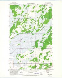
1966 Map of Salol NE
USGS Topo · Published 1968About this map
The international border between the Canada United States and Manitoba Minnesota marks the northern edge of this mid-1960s landscape in Roseau County. This region is defined by a complex network of water management, where the natural course of the Lost River is complemented by engineered waterways like Judicial Ditch No 61 and County Ditch No 18. These ditches reflect the agricultural efforts to drain the low-lying terrain typical of the borderlands during this era.
Find a feature on this map
12 named features on this map. Tap any name to fly to it.
Don’t see what you’re looking for? This feature index may not catch every label — zoom into the map to look around manually.
Map Details
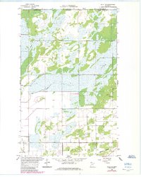
Editions of this 1966 Salol NE Map
2 editions found
Other maps of this area

1918 · Goos
USGS Topo · 1:62,500

1918 · Warroad
USGS Topo · 1:62,500

1943 · Goos
USGS Topo · 1:62,500

1943 · Warroad
USGS Topo · 1:62,500

1954 · Roseau
USGS Topo · 1:250,000

1957 · Roseau
USGS Topo · 1:250,000

1958 · Roseau
USGS Topo · 1:250,000

1963 · Kenora
USGS Topo · 1:250,000

1966 · Salol NW
USGS Topo · 1:24,000

1966 · Malung
USGS Topo · 1:24,000