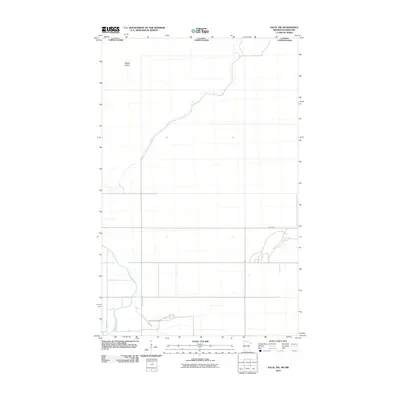
2010 Map of Salol NW
USGS Topo · Published 2010About this map
The Canada United States border defines the northern edge of this Roseau County landscape, where the meandering Roseau River flows northward toward the international boundary. This 2010 survey illustrates a low-lying, watery environment characterized by the winding courses of Lost River and Hay Creek. Notable topographic features rise from the surrounding terrain, including Popple Island in the north and Mattson Island near the southern boundary. The transportation network is built upon a rigid grid of local routes like 400th Ave and 330 St, which provide access to the rural land. The presence of Mattson Island Rd suggests localized access to the named island feature, reflecting how human movement and land use have adapted to the water-dominated geography of the far northern reaches of Minnesota.
Find a feature on this map
10 named features on this map. Tap any name to fly to it.
Don’t see what you’re looking for? This feature index may not catch every label — zoom into the map to look around manually.
Map Details
Editions of this 2010 Salol NW Map
This is the sole edition of this map. No revisions or reprints were ever made.
Other maps of this area

1918 · Goos
USGS Topo · 1:62,500

1918 · Roseau
USGS Topo · 1:62,500

1943 · Goos
USGS Topo · 1:62,500

1954 · Roseau
USGS Topo · 1:250,000

1957 · Roseau
USGS Topo · 1:250,000

1958 · Roseau
USGS Topo · 1:250,000

1963 · Kenora
USGS Topo · 1:250,000

1966 · Salol NW
USGS Topo · 1:24,000

1966 · Malung
USGS Topo · 1:24,000
1966 · Roseau
USGS Topo · 1:24,000