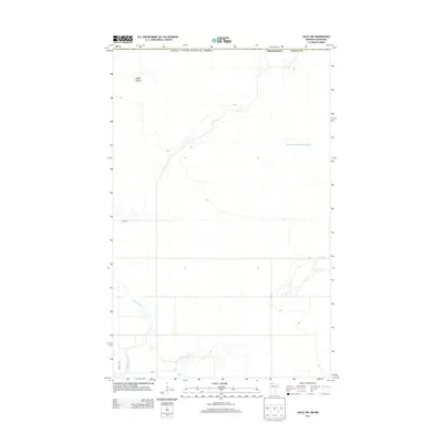
2013 Map of Salol NW
USGS Topo · Published 2013About this map
The International Boundary between Minnesota and Canada defines the northern edge of this Roseau County landscape. Dominated by low-lying wetlands and deliberate drainage projects, the area is characterized by the meandering path of the Roseau River and the engineered straightness of the Judicial Ditch Number Sixtyone. These water management features reflect the region's historical efforts to convert marshy terrain into viable agricultural land.
Find a feature on this map
10 named features on this map. Tap any name to fly to it.
Don’t see what you’re looking for? This feature index may not catch every label — zoom into the map to look around manually.
Map Details
Editions of this 2013 Salol NW Map
This is the sole edition of this map. No revisions or reprints were ever made.
Other maps of this area

1918 · Goos
USGS Topo · 1:62,500

1918 · Roseau
USGS Topo · 1:62,500

1943 · Goos
USGS Topo · 1:62,500

1954 · Roseau
USGS Topo · 1:250,000

1957 · Roseau
USGS Topo · 1:250,000

1958 · Roseau
USGS Topo · 1:250,000

1963 · Kenora
USGS Topo · 1:250,000

1966 · Salol NW
USGS Topo · 1:24,000

1966 · Malung
USGS Topo · 1:24,000
1966 · Roseau
USGS Topo · 1:24,000