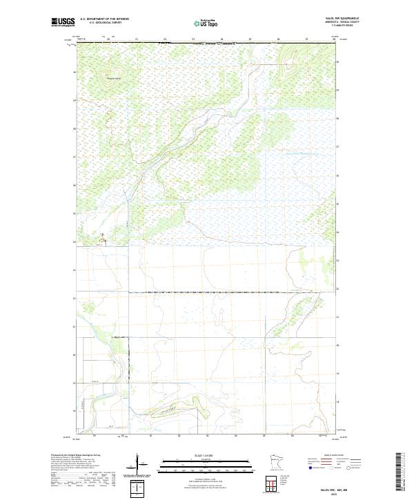
2022 Map of Salol NW
USGS Topo · Published 2022About this map
The Roseau River meanders across this low-lying borderland, defining the drainage patterns of northern Minnesota near the Canadian frontier. In this 2022 survey, the landscape is a patchwork of wetlands and agricultural tracts, managed through an extensive network of artificial waterways like Judicial Ditch Number Sixtyone. The intersection of natural watercourses and human engineering is evident where the Lost River and Hay Cr traverse the township grids. Named terrain features like Popple Island rise above the surrounding flats, while local thoroughfares such as Mattson Island Rd and Co Rd 28 provide the primary access through these rural sections. The map captures the quiet, systematic organization of Roseau County, where the Public Land Survey System squares off a terrain historically shaped by glacial lake beds.
Find a feature on this map
17 named features on this map. Tap any name to fly to it.
Don’t see what you’re looking for? This feature index may not catch every label — zoom into the map to look around manually.
Map Details
Editions of this 2022 Salol NW Map
This is the sole edition of this map. No revisions or reprints were ever made.
Other maps of this area

1918 · Goos
USGS Topo · 1:62,500

1918 · Roseau
USGS Topo · 1:62,500

1943 · Goos
USGS Topo · 1:62,500

1954 · Roseau
USGS Topo · 1:250,000

1957 · Roseau
USGS Topo · 1:250,000

1958 · Roseau
USGS Topo · 1:250,000

1963 · Kenora
USGS Topo · 1:250,000

1966 · Salol NW
USGS Topo · 1:24,000

1966 · Malung
USGS Topo · 1:24,000
1966 · Roseau
USGS Topo · 1:24,000