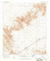
1961 Map of Salome
USGS Topo · Published 1970About this map
The Atchison Topeka and Santa Fe railroad serves as the primary artery through the desert valley, anchoring the mid-century development of Salome and Wenden. This 1961 survey documents a landscape defined by mining prospecting and the management of water in an arid environment. The Harcuvar Mountains and Granite Wash Mountains dominate the horizon, with high points like Harcuvar Pk and Salome Pk overlooking the expansive McMullen Valley.
Find a feature on this map
46 named features on this map. Tap any name to fly to it.
Don’t see what you’re looking for? This feature index may not catch every label — zoom into the map to look around manually.
Map Details
Editions of this 1961 Salome Map
3 editions found

Other maps of this area

1923 · Signal
USGS Topo · 1:250,000

1942 · Signal
USGS Topo · 1:250,000

1942 · Vicksburg
USGS Topo · 1:250,000

1950 · Prescott
USGS Topo · 1:250,000

1954 · Prescott
USGS Topo · 1:250,000

1954 · Phoenix
USGS Topo · 1:250,000

1957 · Phoenix
USGS Topo · 1:250,000

1958 · Prescott
USGS Topo · 1:250,000

1958 · Phoenix
USGS Topo · 1:250,000

1959 · Prescott
USGS Topo · 1:250,000